 CONGRESS (U.S. HOUSE), 2000, Map PR-1
After 2000 Elections |
 PRESIDENT, 2000, Map PR-2
After 2000 Election |
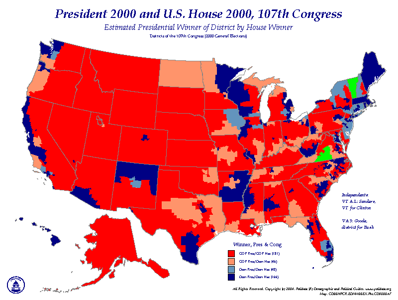 PRESIDENT 2000 & CONGRESS 2000, Map PR-3
District Type |
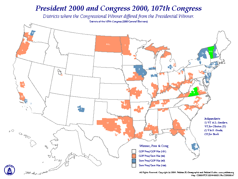 PRESIDENTIAL TURNOVERS, 2000, Map PR-4
Presidential Winner differs from Congressional Winner |
||||||
OPTIONS FOR COLOR MAPS:
|
|
PRICING FOR MAPS:
|
|
SHIPPING/HANDLING:
|
COPYRIGHT © 1994-2005, Clark H. Bensen. All Rights Reserved. POLIDATA ® Demographic & Political Guides
Contact information. EMAIL: info@polidata.org. HOME: www.polidata.org. THIS: www.polidata.org/maps/prcd001r.htm
MAPS: www.polidata.org/maps. updated: 2004-nov-7